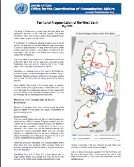
Fragmentation of the West Bank
The situation in Israel/Palestine is very complicated. Below are a number of highly credible documents, maps and power points to help provide a context for understanding the fragmentation of the West Bank
 If you want more maps, go to the OCHA Map Center or the B'Tselem Map Center. Here are a few of our other favorite maps:
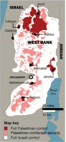
At the center of the occupation and the apartheid system in the West Bank are Israeli settlements. Almost one half million Israelis (460,000) illegally and permanently live in 244 West Bank settlements. These settlements fragment Palestinian territory, bring thousands of Israeli soldiers, hundreds of check points and other restrictions to the Palestinian people. The map below shows Israeli settlements in the occupied West Bank. Settlements are in dark blue and other Israeli controlled lands are in light blue. 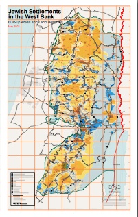 [download] The map below shows how the West Bank is incorporated into Israel through a series of Israeli only roads. West Bank Palestinians are not allowed to use these roads and, in many cases, even cross them. These Israeli only roads create a way for Israelis to travel to and from the illegal settlements in the West Bank. They also create two systems, separate and unequal (apartheid), and fragment the West Bank. 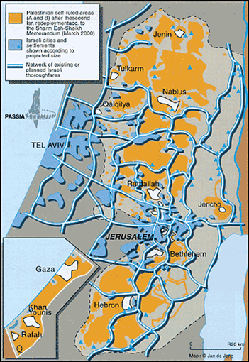 [download] The map below shows permanent check points in the West Bank. As of October, 2007 (according to OCHA), there were 572 check points and barriers in the West Bank.  [download] If the separation wall, sometimes called the annexation wall or apartheid wall, went along the Green Line (the internationally recognized boarder), it would be legal under international law. Unfortunately, it dips deep into the occupied West Bank, creating a no-man's land (seam zone) between the wall and the green line where tens of thousands of Palestinians live with little access to either Israel or the West Bank. They are often cut off from their families, jobs, school and health care. Check out the separation barrier in the West Bank:  Expand / Download |
 See Our Posters  Choose one FREE Sticker   
|